

A summer vacation doesn’t have to mean just lounging by the pool. If you’re eager to explore the mountains on a bike, go hiking along the ridges, and pick up a geocache or two along the way, we have good news for you: you can plan your entire active vacation in a single app.
One app for your entire vacation
Imagine a typical active vacation: a few days cycling along a river, interspersed with a challenging hike in the mountains, and the occasional geocache to spice things up. Until recently, that meant juggling several websites, paper maps, and notes on your phone. With Locus Map, you can handle everything in one place.

You can plan your trip at your leisure at home on your computer, send the planned routes to everyone in your group, and then Locus will reliably guide you on your phone—even in places where there’s no signal. Let’s go through how to do it step by step.
Map selection – biking and hiking maps
A good map is the foundation of every trip. And this is where Locus Map has one of its biggest advantages—it offers a wide selection of map data, so you can choose the one that best suits your plans.
At the heart of the app are LoMaps—our own maps based on data from OpenStreetMap. They include marked hiking and biking trails, terrain shading, and contour lines, so you can see at a glance where a steep climb awaits you. They work great offline, and we update them regularly.
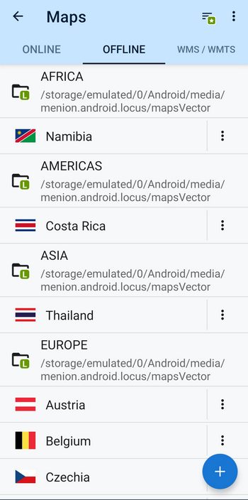
If you’re planning a trip around Europe, you’ll also find specialized online resources helpful. You’ll find the right ones for every activity and region—for example, detailed IGN maps in France, Outdooractive in German-speaking countries, or Swisstopo in Switzerland.
Tip: Before you set out, download an offline map of the entire region. With Premium Gold, you can download all LoMaps offline for free, so you won’t be caught off guard by a loss of signal in the mountains.
Route planning – from the comfort of your home
Locus Map for Android offers the most advanced route planner, but it’s closely followed by the web planner at web.locusmap.app—which now also lets you edit waypoints, their icons, and labels, and displays them on the map. Planning on a large computer screen simply has its own charm: you can comfortably put together a multi-stage route, add any number of waypoints, and select the appropriate LoRouter profile (bike, walking, and more) for each activity. You can also fine-tune the route calculation parameters for each profile exactly to your liking.
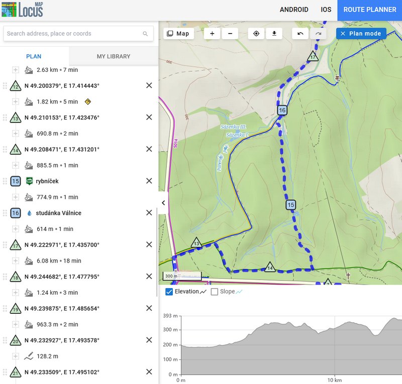
And the best part is that the online LoRouter is free. It’s more than enough to help you plan your vacation from the comfort of your own home. You’ll really appreciate the paid offline LoRouter (Gold) when you’re out in the field with no signal.
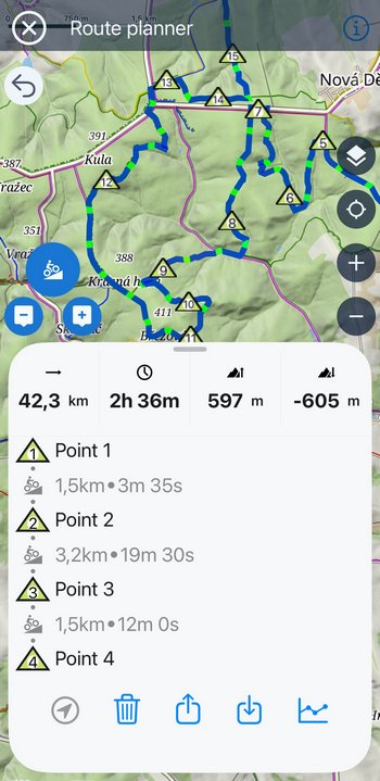
If you’re not an expert at fine-tuning routing profiles or dealing with complex waypoints, you can easily plan your route in Locus Map Lite on your iPhone or iPad—you’ll find a simplified route planner there as well.
All set? Share your route with the whole group
When you’re heading out on vacation with a group, not everyone has to plan the route from scratch. You can simply share the route via a link (URL)—send it to a group chat, and every member of the group can open it on their device with a single click—even those who don’t have Locus Map. The route will open in their web browser. That way, everyone has exactly the same itinerary on their phone, and no one will get lost along the way.
A place to stay straight from the map
Planning your route is one thing, but where will you lay your head each night? Locus Map can help with that, too. For all points of interest (POIs) in the “Accommodations” category, you’ll find a Booking.com button that will redirect you to this popular accommodation portal.
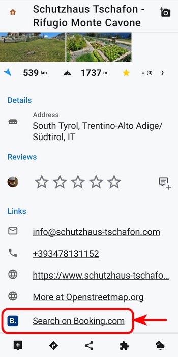
How does it work? The link does not open a specific accommodation listing directly, but launches the Booking.com website or app and enters the name of the POI into the search bar. All you have to do is check availability and prices, then make a reservation.
Geocaching along the way
Geocaching is the perfect way to spice up an active vacation. Locus Map is an official partner of Geocaching.com, so it offers plenty of useful tools for geocachers. You can easily search for caches along your route, download them, let the app navigate you to them, and log your finds both online and offline. Support for waypoints and Pocket Queries is, of course, included.
Think of geocaching as a fun way to spice up your trip—a few caches along the way to the summit or at a rest stop will bring joy and give you the motivation to pedal on, especially for kids.

Offline in the field
Once everything is planned and shared, there’s just one last step: preparing the app for a trip without a signal. Download offline maps, routing data, and planned routes in advance, and Locus Map will guide you seamlessly through even the most remote corners of the countryside. This is where the offline LoRouter from the Premium Gold package comes in handy, as it recalculates your route even without a connection.
Voice-guided navigation along the route is a given, so you don’t even have to take your phone out of your pocket. When cycling with your phone mounted on the handlebars, it’s also handy that the screen turns on automatically at turns so you don’t miss any. Discovering new hidden paths can be an adventure, but you definitely don’t want to end up somewhere in the nettles and swamps—especially with small children.
While you’re out riding, turn on track recording with real-time statistics on speed, elevation, and distance traveled, so you’ll have a keepsake of your adventures. And don’t forget to take photos! Locus Map can display your photos over the map or in the track details of your trips.
Set out on your active vacation
From the initial inspiration, through route planning and booking accommodations, to navigation on the trail—Locus Map will guide you through your entire active vacation. So what are you waiting for? Open the web planner, plan your next trip by bike or on foot, and set out to explore. Adventures await.
androidmapsroute planningtipstripvacation


14 Comments
Bonjour,
Pourquoi avez vous changé la couleur des pentes. Auparavant les couleurs étaient bien visibles et bien colorées. Maintenant avec les nouvelles couleurs on ne voit plus le parcours qui se confond avec la carte. Vous pourriez donner le choix de choisir l'ancien mode ou le nouveau en fonction des goûts de l'utilisateur. Sinon comment peut on revenir à l'ancien mode
Merci
Hello,
Why did you change the slope colors? Previously, the colors were clearly visible and vibrant. Now, with the new colors, the route is no longer visible and blends into the map. You could offer a choice between the old and new modes depending on the user's preference. Otherwise, how can we revert to the old mode?
Thank you
Hi Alain,
the slope gradient colors were tuned based on the demand from the Locus Map community - the ascents are colored in warm tones of yellow, orange and red and descents are in tones of blue. The flats are neutral - grey. We are not planning to change this coloring and it can't be customized at the moment.
Bonjour Alain,
Ces nouvelles couleurs de pentes sont basées sur des valeurs fixes de pente (+/- 1%, 1-5%, 5-10%, 10-15%, plus de 15%) et non plus par rapport à la pente maximum de l'itinéraire.
C'est différent, mais pratique. J'étais souvent perturbé de voir une pente en rouge alors que c'était du 7-10%.
Merci Raph pour ce complément d'information. En effet c'est plus précis. Ça m'aideras peut-être à accepter ces vilaines couleurs 😊
I second Alain's message about the inability to allow the user to customise the colours. I'm green/red colour blind, quite a sizeable portion of men in particular are too, and would benefit greatly from being able to customise colours.
Secondly not being able to bisect and merge routes is disappointing in the Web app and seems a strange omission. I've resorted to using GPS studio to do this.
Hi Fergus,
the dynamic coloring of the tracks by speed, altitude, slope, etc. has never been customizable. Besides that, the customization options for plan-colored tracks are numerous - you can set any color, thickness, outline with its own color, patterns... No further customizations are planned at the moment.
The web app - if you need to crop or divide a route, you can do so by opening the route in the planner, deleting the unwanted route points, and saving the cropped route as a new one.
I've almost never been able to use this app to guide a route. I'm able to load a gpx file so the route is there, but to actually start it and use it, no. This is one of the most unintuitive apps I've come across. I just want to click a button and it starts navigating the route, on my android phone and watch. This is extremely simple in other apps such as Komoot, which is what I had to end up using the other day as I just couldn't get locus to work. It was doing something and was running in the background even after I'd turned it off, I had to force stop it in the end. The watch was also doing something, but I don't know what, certainly no map or route was displaying.
You need to work on that.
With Komoot, I simply clicked the route I wanted to follow, then there was a big green button on the screen saying "navigate on phone" I clicked that and navigation began, on the phone and watch and we were guided round our route.
I really want to like your app as it allows maps on my watch, so I can use just that and leave the phone in my bag, but I've no idea how to use it! I've tried, I've read up and only once had this worked. It shouldn't be this challenging!
Hi Mart,
to navigate a route, either tap it on the map or in the library and then tap the navigation button in the bottom bar > select navigation > press start (more info: https://docs.locusmap.app/doku.php/manual:user_guide:functions:navigation:along-route).
No map on your watch - if you have a Wear OS watch, please install the Locus Map Watch add-on on it and on your phone too. Make sure both Locus Map and Locus Map Watch are excluded from battery optimization. If you have a Garmin watch, there is no map - Garmin banned third-party apps from mirroring maps on the watches to protect its own maps.
If you need help or advice, please don't hesitate and get in touch at help.locusmap.eu.
My previously purchased LoMap of my state worked till the spring 2026, but the application does not want to open it recently. Whats the issue?
Hi, please remove the defunct map and reload it from the Locus Store for free.
For free is not possible.
After login in and pressing the update button, I get the following blocker:
"You need an additional 85 ... to purchase Czech republic - LoMaps"
Please contact us at locus.map@asamm.com, describe the problem in detail and send your Locus account address. Thanks.
Who cares! I don't want you app to send me such useless notifications!
Hi Dusan, you can turn the "Locus news" notifications off in your system settings.