The OpenStreetMap.org data, which is the base for our LoMaps is not just about mapping roads, trails, forests, ponds, bike paths, and hiking trails. It also includes an extensive database of so-called points of interest, which we call LoPoints. They mark everything possible, from small natural objects such as springs, through mountain peaks and other natural attractions to the creations of human endeavor – castles, chateaux, museums, and other sights. However, unlike the databases of large commercial companies such as Google, OSM points still suffer from certain brevity of the information they carry – both descriptions and photos.
The newly released Locus Map 4.6 brings a completely unique solution to enrich LoPoints. Our team managed to connect the OSM database with another open information platform – Wikipedia. The thing is, in addition to texts and photographs, many records in this worldwide encyclopedia also contain information on the location of individual objects.
For Locus users, this creates another great way to enrich planning a route or the whole holiday.
It works online
Because Wikipedia is an online encyclopedia, you need to be connected to view it. Fortunately, museums, castles, and chateaux are mostly in well-covered areas, so the availability of information should not be a problem.
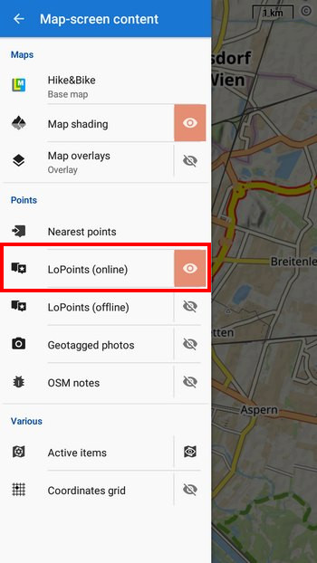
In the content panel at the bottom left, just activate online LoPoints and you can start browsing:
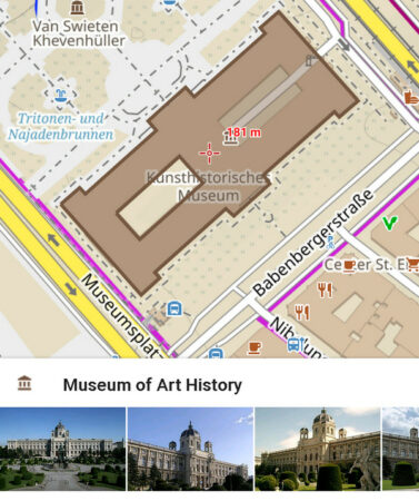
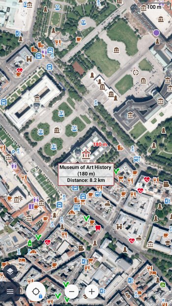
Click on the castle or museum icon and a panel with photos and a description will appear at the bottom:
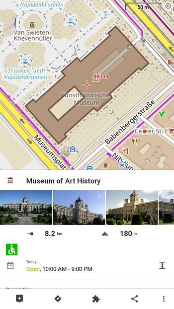
For more details about the object, just slide the panel up.
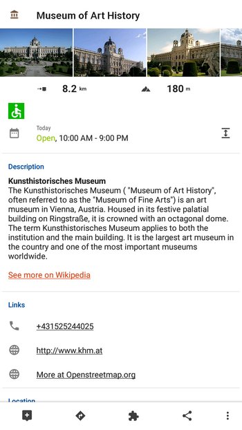
Tap each photo to display it individually in full detail:

Wiki speaks your language
The language of the Wiki descriptions is the same as the language you use in the application. So for example, if you have the Locus menu in Czech, the labels will also be in Czech. This is an advantage mainly in the Czech Republic, where most Czech-language Wikipedia articles are located. Where Wikipedia does not offer a Czech equivalent, you will see a caption in English.
In addition to the Czech and English Wikipedia, Locus Map also loads from Slovak, German, Polish, Russian and Italian Wikipedia. And we’re working on adding more languages soon.
Display LoPoints above any map
LoPoints are not just the domain of our LoMaps. If you like another provider’s map, just turn it on and activate online LoPoints in the content panel:
Navigate and plan trips
Of course, you can set online LoPoints as the destinations of your walks, or include them in the trip route.
In the first case, just tap on the point and select Navigate to from the bottom bar (if you want to start navigating straight away and not to edit the route more):
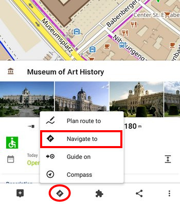
or Plan route to – if you need to further tune the route in Locus planner:
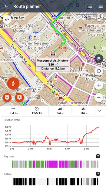
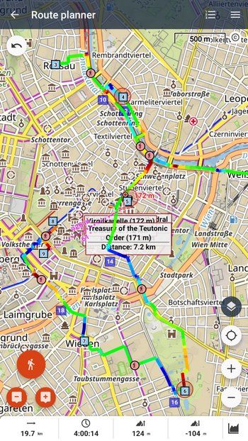
If you want to plan a trip around Vienna sights, for example, first start the route planner and add points one by one:
We believe that you will definitely appreciate the richer content above the maps in Locus, not only when planning your trips for the upcoming season!
LoMapsLoPoints onlineOSMphotoswikipedia


9 Comments
Connecting the open World! Great! Thanks for keeping adding great features!
What is not clear to me yet is how we can use Locus Map to contribute new points and information about them to the global database. Any tips will be very welcome!
Hi Ricardo, anyone can use standard, known channels to contribute to Open Street Map dataset and Wikipedia. Eventually, these contributions will be seen in Locus. We don't have the ambition to build another channel (And compete with well established workflows). Building and maintaining a rather small, specific set of community based data - this may be happening in the near future.
Tak to je dalsia skvela sprava. Len tak dalej dobra praca
Great and useful feature – thank you!
@Ricardo: Vespucci is a very comprehensive OSM-Editor for Android.
"Always on" will be wishful thinking as long as Smartphones do not connect via satellite internet.
I definitely congratulate the team to this POI feature achievement.
It is half the way only, though. Pls. get the Wikipedi links into your offline DBs. And make sure you feed Aard2 and Kiwix with the correct links. Then you achieve full offline capability.
Schöne Ergänzung, nur die Icons sind nach wie vor etwas klein geraten und die Größe ist, soweit ich weiß, auch nicht durch irgendwelche Einstellungen zu ändern. Ist da was geplant?
Hello, I changed phones and transferred Pro or Classic to the new phone. I downloaded the Washington state Lomap in updated form (August, 2022) to see the buildings and structures are no longer included in the updated map. Did I do something wrong or is that data no longer in the maps? Is that data included in Locus 4?
Hi, please contact us at https://help.locusmap.eu/ticket/add and send screenshots of the problem. We'll have a look at it straight away.