The most colorful outdoor season of the year is here. To make it more enjoyable for you, we prepared this new version with two major novelties: handy Route Planner and Track Editor. There are of course some other nice improvements on top.
Route planning easier as never before
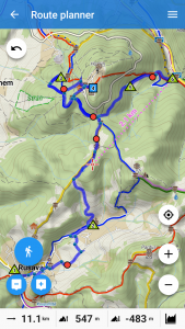
Although the vast majority of modern android phones have large screens, planning routes on a mobile is still not a comfortable matter. We have decided to change it. First of all, we completely re-designed the route planner screen.
Less buttons, better functionality
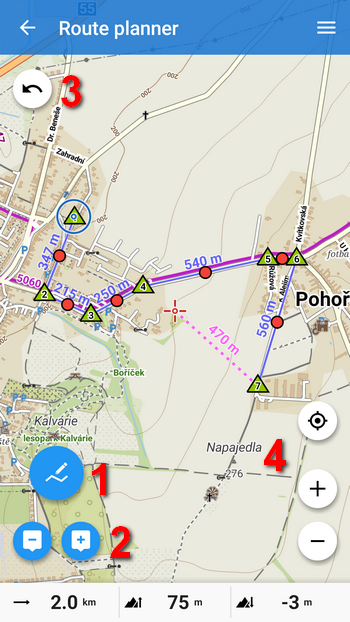
There is everything you need for quick and intuitive route planning:
- drawing mode – here you can choose between manual drawing and automatic route rendering with routing profiles (bike, walk, car …)
- add/remove routepoints
- back/forward – you can move in the steps of your drawing
- zooming buttons and the button positioning you in the center of the screen (centering button)
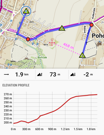
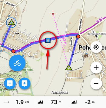
Bottom bar displays basic route statistics – distance, positive and negative elevation. The bar can be slid up to show the current elevation chart in the Pro version:
Fast planning with shaping points
By tapping ![]() (add point button) you create so called shaping points
(add point button) you create so called shaping points ![]() . You can add them also by tapping directly on the map. If manual mode is selected (default setting), a simple straight line is drawn between the points – this method is more suitable for easy distance measurement or for areas where routing data is not available:
. You can add them also by tapping directly on the map. If manual mode is selected (default setting), a simple straight line is drawn between the points – this method is more suitable for easy distance measurement or for areas where routing data is not available:
The planner can create the route along the roads and paths automatically. You just need to select a drawing mode according to your activity. Then, the route si drawn between the shaping points. If you choose walking, the route runs along footpaths, if you chose a bike the planner uses roads.
You can manage the route by freely moving of shaping points ![]() and auxiliary points
and auxiliary points ![]() . Besides you control the elevation gain of the route in the bottom bar where the chart changes accordingly.
. Besides you control the elevation gain of the route in the bottom bar where the chart changes accordingly.
To navigate through certain places even during recalculation while driving, change the shaping point to the via-point – tap it and select “Change to via point“. The via-points, marked ![]() , can be named – the name will then be heard in the voice navigation.
, can be named – the name will then be heard in the voice navigation.
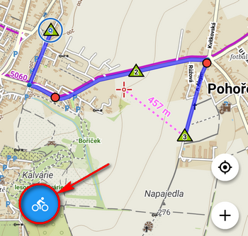
You can also add LoMap points of interest (POIs) to your route. Tap the point and select an option where the point should be located – at the start, in the middle or at the end of the route. Such a point is automatically marked as via point.
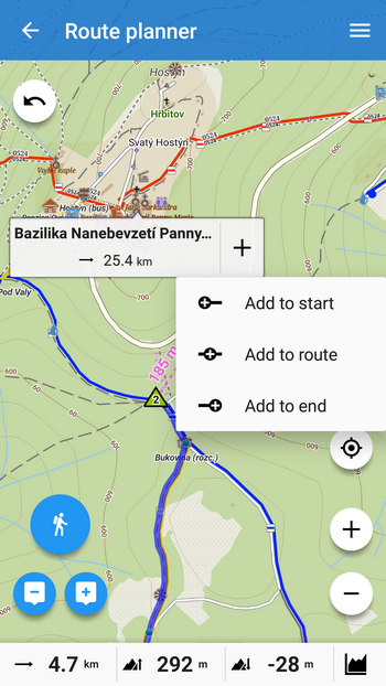
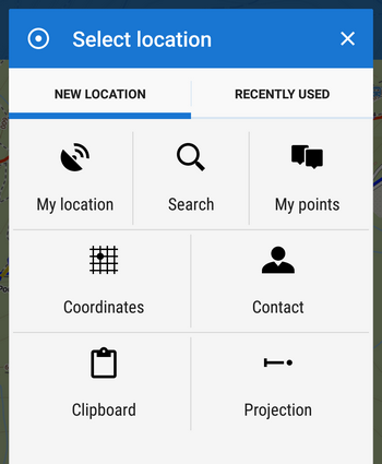
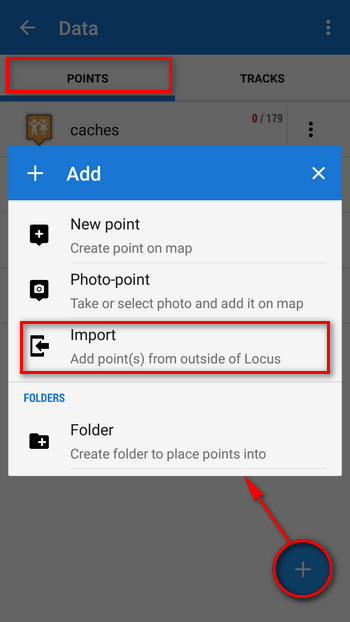
If you have your own points in Locus – your places of interest, geocaches etc. – or points that have to be especially defined (e.g. addresses), you can add them to the route as well. Open the route menu (top bar right corner) and select Add point:
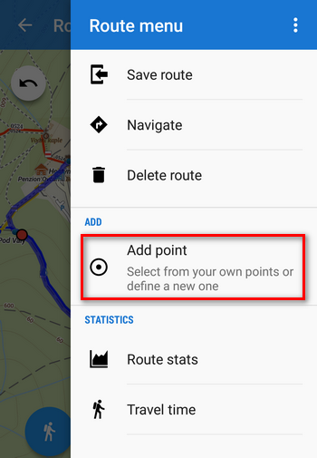
Then, select My points if you want to pick from your own database or other ways of point definition:
Check detailed statistics for better results
Detailed statistics and elevation chart of the route plus estimated Travel time can be found in the route menu as well.
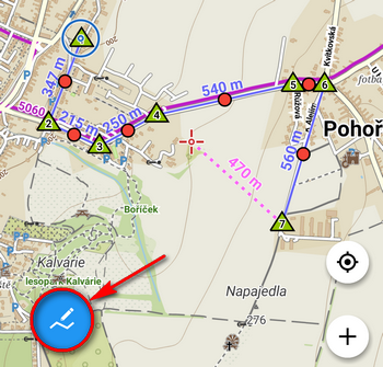
You can navigate along the new route simply by taping the Navigate button.
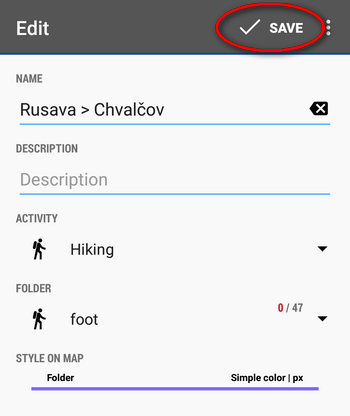
When your planned route is finished, it’s necessary to save it. In Route menu, tap Save route, name it and select the folder and activity.
If you want to abort all your editing, tap “Delete route” in the route menu.
Track editing with cool tools
Another good news is that we bring more options to edit your track or route:
1) to re-plan your route, just open it in the Route planner and go on as with a new route:
2) if you want to:
- erase part of the track
- split it in two
- or insert a gap etc.
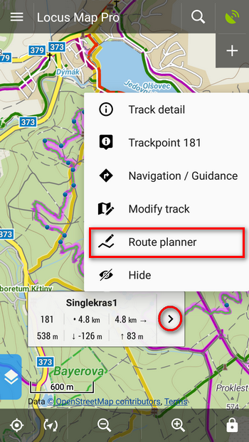
…use newly re-designed track editor. Just tap the track on map and select “Modify track“:
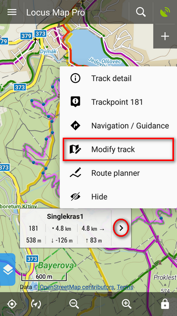
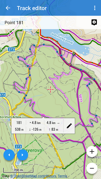
Cursor is placed on the spot of the track you tapped which pops up a label, showing trackpoint stats – distance from the start and from the end of the track, elevation gain etc.
 editing tools
 move the cursor along the track from one trackpoint to another for their precise selection.
- + – Zooming buttons
The editing tools allow you to:
- cut various parts of the track – inner part, from the start to the selected point or from the point to the end – useful for example when you forget to stop track recording of your the trip when you get the bike on your car roof rack and travel home.
- If you have multiple day track record, you can split it in individual days.
- You can also insert a gap for the case you traveled through a tunnel and want to hide the line connecting GPS-fixed trackpoints.
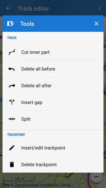
The editor allows also precise tuning of individual trackpoints – basic particles of the track. You can move them, add new or delete unwanted. Select a trackpoint, then Insert/edit trackpoint or Delete trackpoint from the Tools menu. The editable trackpoints surrounding your selection are highlighted ![]() and auxiliary points
and auxiliary points ![]() . By shifting them you can change shape of the track:
. By shifting them you can change shape of the track:
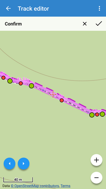
All changes must be confirmed in the topbar.
Better user experience
We hope you’ll enjoy these renewed features as much as we do. And not just them – great majority of recent changes in Locus have been made in order to improve user experience. Among others let’s mention at least re-designing the point adding dialog. We rewrote all texts and added point import into it. Hopefully, this dialog is now much more comprehensible for both old and new Locus users:
And now, put your phone in your pocket and get outdoors! And don’t forget to take autumn-nature-colorful-leaves pictures and share them with us!
Locus Mapnew releaseroute plannertrack editor


19 Comments
GREAT !
Any way we can get the router to follow existing/visible user tracks when the router doesn't know the route? Right now, I have to create 2 or 3 tracks and merge them together... it's a bit cumbersome. This would be a dream feature for me!
Thanks for creating the best Android app there is!!!!!
Amazing work menion... as always. But the captcha on this comment form doesn't work on Chrome mobile... needed to reload the desktop version of the page.
Hi, sorry about that... but it's a Wordpress plugin, we don't develop it. Perhaps an update will help.
Supr. ? ?
That's one of the best changes recently! Very nicely implemented. Thanks a lot.
Well done!!!
Andreas
Absolutely fantastic. Greatest feature in the best app ever! Honestly you are doing a great job.
Great changes, thanks from Germany!
Dobrý deň
Rád by som vedel ako si môžem zmeniť formát suradnice .
Ďakujem
Dobrý den,
v nastavení Locusu > Jazyk a jednotky > Souřadnice
Sounds great. Will try to check out as soon as I get off the office here *cry ...
Hi,
great improvements, BUT there is one big downfall for me in this update. I used to work a lot with coursepoints (navigation waypoints with arrow icons) during creating/editing tracks. That was easy before update as I could go through all trackpoints by clicking on arrows and select whether I want to add or erase navigation points. Now, I am able to go through trackpoints via “edit track” but I am not able to change navigation points like this. I even don’t know how to do it at all now, as “+” button under track waypoints screen can add only ordinary waypoints and not the navigation waypoints with arrows.
So now it seems navigation points in tracks can be only automatically generated, but they are not manually editable. Am I missing something? I can provide some screenshots if necessary.
Thanks Jan
Hi Jan,
navigation points can be added/deleted in Route planner, their icon(navigation command) edited in their detail screen. See https://docs.locusmap.eu/doku.php?id=manual:user_guide:tracks:editing#editing_navigation_commands
Oh great, I missed this, thanks! So no complains here, but anyway I would still prefer option to create/delete navigation points even in track editor under tools menu for particular trackpoint. It was more convenient to work with them using buttons for next/previous trackpoint selection mainly on tracks which cross itself, so there are more navigation points on single location. But I see everything can be done even now under route planner, so this is only about usability comfort.
Warum gibt es keinen Routenplaner für den PC mit einfacher Übertragung der gpx-Datei auf das Smartphone? Siehe Komoot ...
Karl
Hi Karl,
Locus Map is a completely mobile app without web or desktop background. If you want to use Komoot routes, export them from Komoot website as GPX and import to Locus.
Je spústa možností editácie farby a ich kombinácií záznamu a návrhu. Chýba mi možnosť prerušovane (bodkovane atď) tak aby neprekryl mapu úplne. Je k dispozícii priehľadnosť, ale nie je to ono. Často sa pohybujem po neznačených cestách a chcel by som vidieť či tam bola červená alebo zelená lesná cesta z WMS.
Ináč som z Locusu nadšený. Ďakujem Vám zaň. Peter z Košíc
zdravíme, v nastavení stylu linie trasy vypněte linii, zapněte vzor (tečky, šipky...) a zvolte barvu. Výsledkem je to, co potřebujete.