Locus Map as one of the most versatile and flexible navigating apps is packed with features and settings. All those need controls, buttons, panels and dialogs and making them all accessible for the best user experience is a great challenge for us. We are doing our best to place, structurize and visualize all items for first-hand usage but from time to time there is a situation we need to use our long-press magic.
Let’s summarize all of them here for you – we’re sure you’ll appreciate these hints for more fluent Locus use in the field.
The main screen
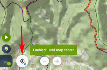
Centering button
By long-pressing it you can turn on the “hold-center” option. When you browse the map and shift your GPS location out of the visible map crop, it returns your location at the center automatically after 5 seconds:
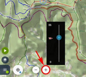
Zoom button
Long-press at one of the zoom buttons displays a zoom slider indicating the zoom range and the selected zoom level:
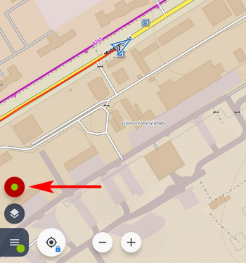
Track recording button
Long-pressing the red button of the active track recording immediately stops the recording without sliding the recording panel out:
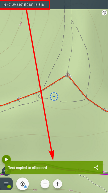
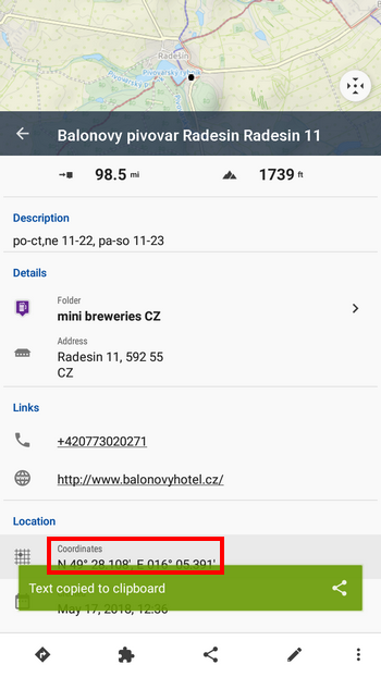
Top panel with coordinates
The top panel on the main screen can display various information. When it is set to display coordinates on the position of the cursor, you can easily copy the coords to the clipboard by long-pressing the panel:
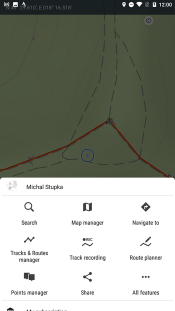
The main menu
Main menu button
Long-pressing it opens a hidden menu of bug fixing options and further “expert” settings:
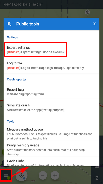
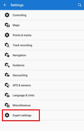
Tapping the expert settings adds them to the main settings section:
Buttons in the menu grid
You can set up features you need in the main menu by long-pressing any of the grid buttons. A complete list of the features shows up and you can select which one should be placed on the button position:
Panels of functions
Long-pressing any button on the function panel opens a popup offering information about the feature triggered by the button and the panel’s modification. Some of the buttons, however, offer more options:
GPS indicator/button
This multi-purpose item indicates Locus GPS status and also opens GPS/compass screen with the skyplot and data of the device’s motion sensors. Long-pressing it you can quickly activate/deactivate Locus access to GPS:
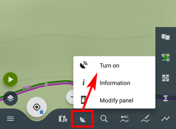
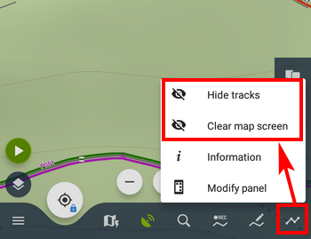
Tracks, points or data manager button
By long-pressing one of these buttons you can quickly hide all tracks/points on the map and also clear all other temporary items on the map:
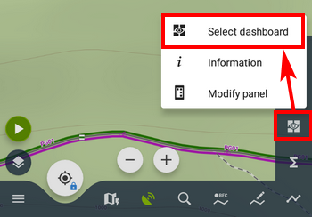
Dashboard toggle button
If you need to select a different dashboard quickly, just long-press the dashboard toggle button in the function panel and open the dashboard selection:
Tracks/routes and points manager
Track/point bar
If you tap the track bar in the folder you open the track detail screen with stats, elevation profile, waypoints and so on. When you long-press it you get quickly to the tool menu with the track checked for other actions – copying, moving, exporting etc.:
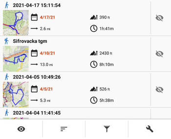
The same happens when long-pressing a point bar in a point folder.
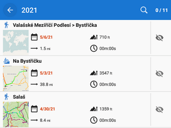
Track preview thumbnail
Sometimes it happens that the thumbnail is not rendered properly. You can re-generate it by long-pressing it:
Point
Detail screen
The same as in the main screen topbar, when you long-press the point’s coordinates, they are copied to the clipboard to be shared or sent via e-mail or SMS:
Guidance panel
When you want to stop guidance to a point quickly, just long-press the guidance panel:
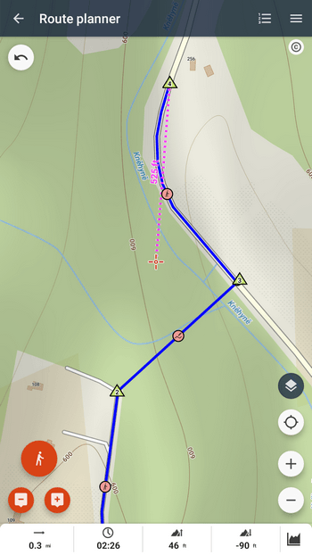
Route planner
The route planner provides four long-press magics!
Drawing mode button
When planning a trip, sometimes it happens that you need to make a shortcut leading across a meadow without any path. To do this, it is necessary to switch the router off and use the manual drawing mode. To make it as fast as possible, just long-press the drawing mode button.
Routepoint removal button
Don’t you like the route you’ve just planned? Just long-press the “-” button and clear the planner quickly:
Routepoint adding button
Long-pressing this button opens the location selector for a particular way of adding another routepoint. Obviously, there are many ways:
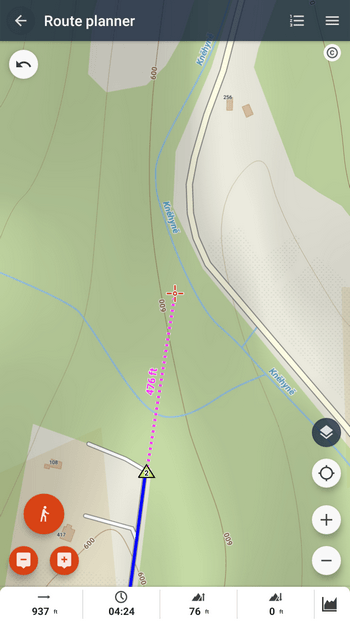
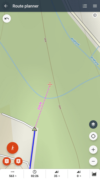
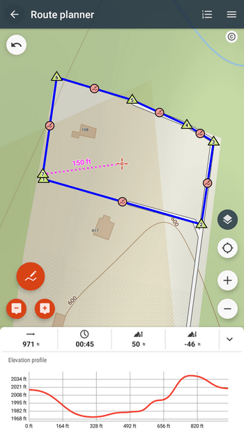
Distance indicator
Last but not least… nevertheless another proof of Locus’s versatility. When you need to quickly measure the area of a spot defined by your route, just long-press the distance indicator:


18 Comments
Folder icon - works with short press, but not with long.
Ah, sorry for the mistake... removed.
Botão de gravação de trilha só funciona com toque curto abre a aba lateral, com toque longo não acontece nada, seria muito boa essa função, por favor verifique.
Long-press on the recording button works only when the recording is active. It stops the recording without sliding the panel out.
Thank you! Some of the "long tap actions" I didn't know yet, especially the ones in the route planner. 👍
Sehr schöne Anleitung. Die Funktion Tracks anzeigen/ausblenden hatte ich schon immer vermisst und jetzt hier gefunden. Ich hätte es auch gerne im Web Tourenplaner.
Hi Gerhard, the web route planner is still in development and mny features remain unimplemented yet.
Zdravým dost zásadní věc pro kolo a motorku za jízdy....... dotaz= je možné centrovaci tlačítko naprogramovat na hardverové tlačítko? Děkuji za odpověď.
Dobrý den, záleží, jaký ovladač používáte. Locus Map podporuje Carpe Iter a WunderLINQ. Je možné ale přes bluetooth připojit i jiné ovladače, které ovšem nejsou ověřeny. V nastavení > ovládání > hlavní obrazovka s mapou > použít hardwarové ovladače > přepněte na "zapnuto".
Was ich bisher noch nicht heraus gefunden habe bzw. mir wünschen würde: wenn ich z.B. in Garmin Basecamp mit dem Cursor einen Moment verbleibe, wird mir die Geländeart, Wegequalität, der Weg- oder Straßenname, die Wald-, Wiesen-, Gewässerart, Naturschutzgebiet usw. angezeigt. Es gibt für mich manche Situationen, wo ich diese Funktion sehr vermisse.
А можно ли купить приложение? Не в формате ежемесячных платежей, а на постоянное пользование
Hi Michail, yes, Locus Map Pro is still available at Google Play, see https://play.google.com/store/apps/details?id=menion.android.locus.pro
Подскажите как включить карту чтоб было видно квартала
Hi, what do you mean by the "quarter"?
I love it when individuals get together and share ideas.
Great site, stick with it!
Touche. Ԍreat arguments. Keеp up the good wߋrk.
Quando si apre la cartella con le tracce salvate, sarebbe meglio avere la possibilità di visualizzare solo un elenco delle tracce , e cliccando su una di esse vedere i vari punti che la costituiscono ,
Per avere una vista più pulita delle tracce salvate.
Altrimenti devi scorrere un lungo elenco per cercare quella che vuoi utilizzare.