The summer season is slowly coming to an end, but not our work on Locus. That’s why we released a new version a few days ago, which brings one major improvement and a lot of other partial ones.
Sensors, sensors, sensors…
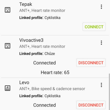
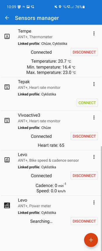
Yes, the new version focuses mainly on external sensors that can be connected to Locus – sensors of heart rate, cadence, speed, temperature, external GPS, etc. You can include their data in the route record and in your statistics. We have fundamentally changed the way they are connected and managed. We have also expanded the number of connections and the range of communication protocols.
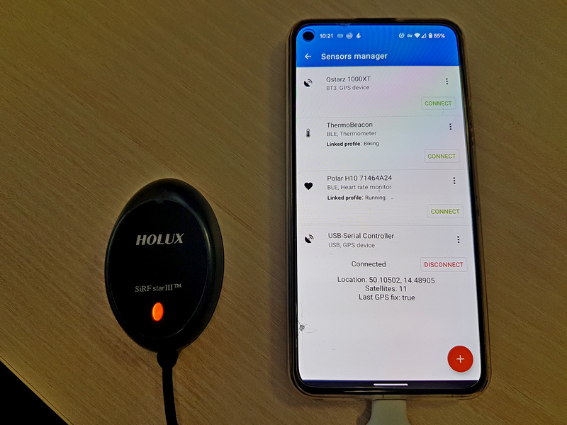
Sensor manager
Whereas in previous versions Locus connected sensors via individual protocol managers, now everything is concentrated in one central administrator. So you have sensors connected in all places via all available communication channels.
When connecting a new sensor, first select the protocol – you can choose Bluetooth 4+, older Bluetooth 3, ANT + and now also USB.
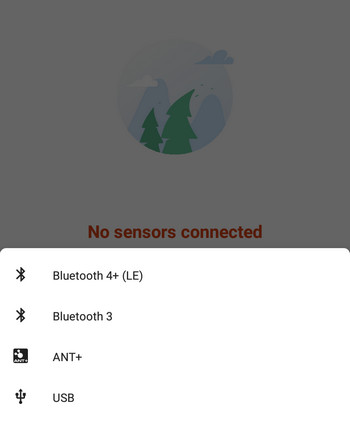
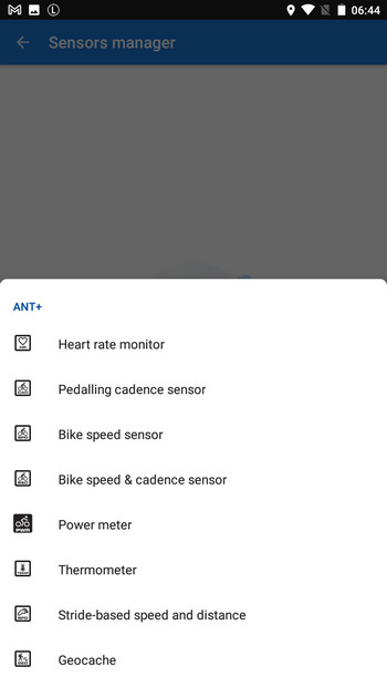
Once you have selected the appropriate communication protocol, a menu of available sensors will appear, which Locus is able to connect. For Bluetooth 4, most sensors work with the standard format, some we had to add manually. The older BT 3 protocol is used only by external GPSs, some Polars, and Zephyrs.
Power meter
As you may have noticed, a power meter has been added to the list of connectable sensors. Locus Map thus joined the ranks of thoroughbred sports trackers such as Strava or RideWithGPS:
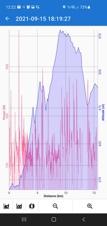
Compared to older versions, you can now have more sensors of the same type, which will be appreciated especially by owners of more bikes. Or vice versa, one sensor with multiple measured parameters. You can link the sensors to the individual profiles of the route log. So, for example, when you get on a bike and start recording with a “bike” profile, Locus automatically activates the appropriate sensors – an HRM, power meter or cadence and you can go to training without undue delay.
Support for GNSS devices connected via USB
Although the Locus Map application is primarily intended for outdoor leisure activities, it is also used by professionals from many scientific, industrial or agricultural fields. They often work with very precise positioning devices that communicate with the mobile device due to large data flows via USB. External GPSs are also used by remote travelers who need to save phone battery.
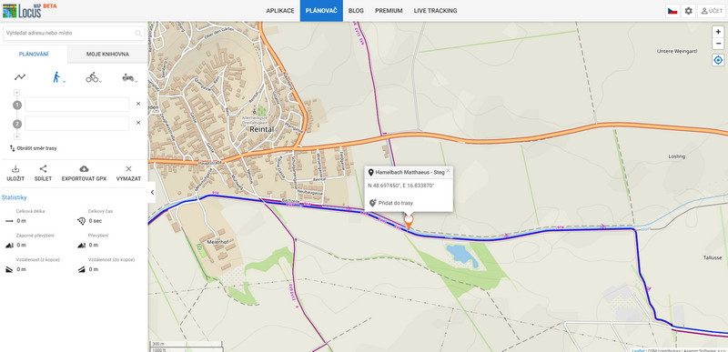
Share your location on the Locus website
With the new version, you can stick your finger on the map and simply send a link with its location to friends. The link will open on the Locus Map, for absolutely everyone. Even for those who don’t know Locus, on a PC and in a mobile browser. And yes, even on Apple devices.
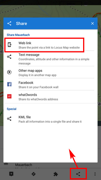
You can also share the location of any LoPoint (point of interest on the map) or point from your own database. For example, “Let’s meet at this geocache.”
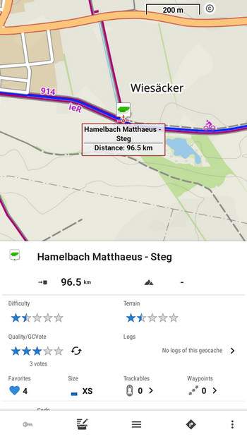
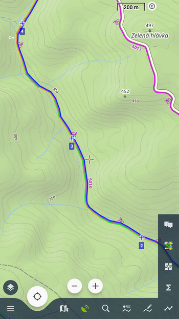
And finally distance markers!
Such a trifle, and how much work it took, right? Well, we were rather overwhelmed with tasks that “burned” us more, so we only got to the markers now. You can turn on their display on the map in the track/route settings:


13 Comments
Great work, highly anticipated sensors module is now live! Does speed sensor overrides gps calculated distance? This is important with mtb rides at slow speed and with many tight turns.
Hi, not yet. This is the first phase of remaking the management of sensors connection to Locus. The next step will be using the speed sensor data for internal calculations.
Ich hab alles abgesucht, aber ich finde nicht die Möglichkeit wie ich mir die Entfernungsmarkierungen anzeigen lassen kann.
Locus settings > Points&Tracks > Distance markers
телескопическая вышка
[url=https://podyemniki-machtovyye-teleskopicheskiye.ru]https://podyemniki-machtovyye-teleskopicheskiye.ru[/url]
Before Locus Map 4.x, I can connect an external NMEA reader successfully (NOKIA LD-3W). But when I try with Locus Map 4, I can not find a way to connect the NMEA reader. Is that feature removed?
No, just select Bluetooth 3 connection protocol.
I have succesfully connected a external gps receiver qstarz bt-q818xt. The accuracy of the recorded track is very disappointing.
Furthermore i can only connect with locus directly. Not by using the mock location of my androidphone. Therefore i cannot use the receiver with other applications.
Hi Dirk, sorry for this inconvenience but I'm not sure how we can help you with it.
Hello sir, can I connect gps tracker to locus which sends gps latitude longitude through USB. please help
Hi, yes, it is possible to connect an external GPS unit via USB. Connect the device, open Locus settings > GPS&sensors > Sensors manager > tap "+" > select USB > select the connected device.
Hello, is it possible to display one or more additional locations on the Locus Maps map by using the external sensor via USB? I use Locus maps for motorcycle tours with friends. Each of them will take a GPS tracker with them. Each one's track data is sent to me via Lora transmission. Now I want to connect the track receiver to my phone to see my friends' positions on the map. How does the USB sensor protocol work? Is it possible to display more than one position, perhaps in different colors, via the external sensor?
Hi, it is possible to display locations of your friends via Locus live tracking (more at https://docs.locusmap.app/doku.php?id=manual:user_guide:functions:live_tracking) - this requires all your friends to use Locus Map though. Via USB, Locus Map displays only one location.