“Hey bro, you work with these maps, eh?…”, recently a friend of mine asked me and I was about to explain again that I was collaborating on developing a mobile map application rather than mapmaking. “I want to exchange some land near my cottage with Frank and I need to check it out according to the cadastral map …”, he continues without interruption and I am relieved – I don’t have to explain anything: “Sure, I can handle it with Locus.” And I’m looking forward to the White Carpathians – I’ll copy the plot to Locus according to the cadastral map and then we’ll mark it with wooden pins in the field – nothing official, just approximately, so the accuracy of GPS, which makes some 3 m in the place, will be enough.
1. I looked into the Land Register
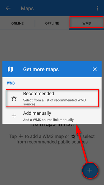
I was not at the computer so I could not use the great Ikatastr.cz services , but I had a cell phone and a wifi access was nearby. I turned on Locus and opened the WMS Map tab in the map manager. I chose the option of recommended WMS data sources:
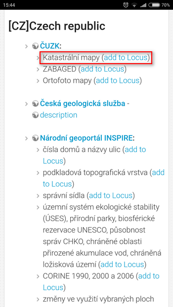
I selected the source of the Cadastral Maps of the Czech Land Registry Office:
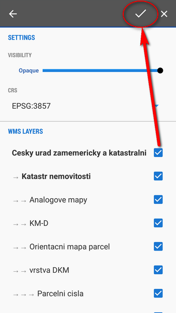
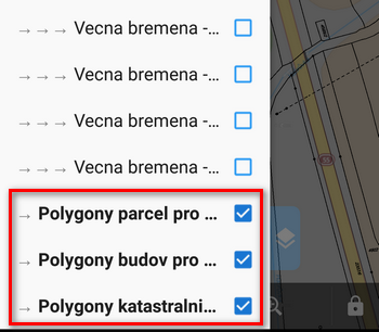
And in Locus, I checked all the map layers needed:
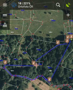
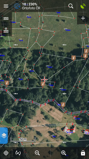
As a background, I chose an aerial map from the same office, the cadastral map beautifully drawn above it.
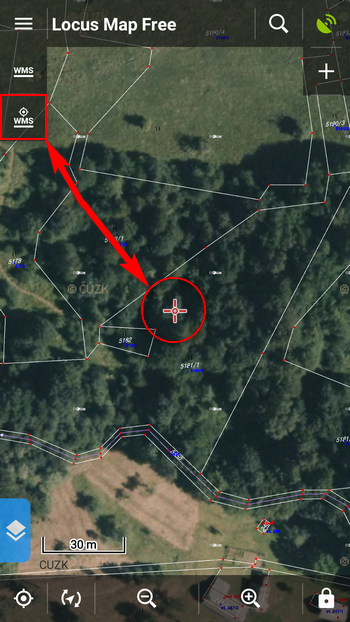
I pointed the cursor over the plot and clicked on the plot information button to make sure I displayed the right one:
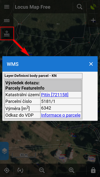
After a few more clicks I verified ownership of the parcel on the site of the Land Registry, to be absolutely sure.
2. I transferred the plot to Locus
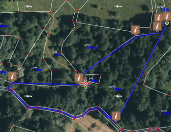
From my friend I had GPS coordinates of the points on which he would like to place provisional pins. I quickly brought them to Locus:
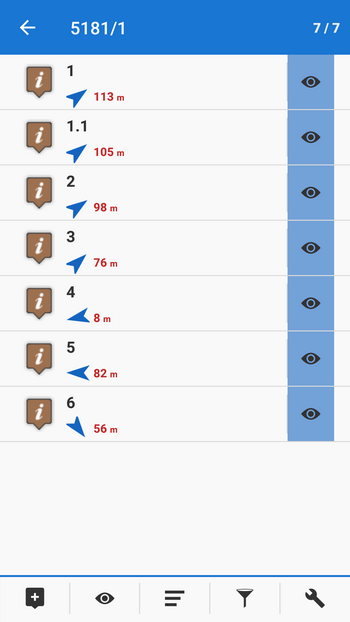
Their positions perfectly matched the boundaries of the plot on the map.
In the field I will be without the Internet so I copied the plot to Locus using the “Add new route” tool:
I’m ready, we can go.
3. Let’s go out!
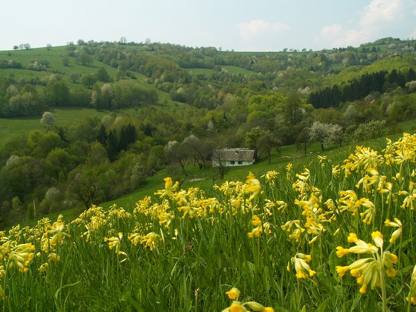
The captivating landscape of the White Carpathians always gets me, especially in the spring, when local meadows are blooming, full of rare flowers.
We put the pins and a hammer in our backpack and set off. Locus obediently guided us to the border points of the parcel:
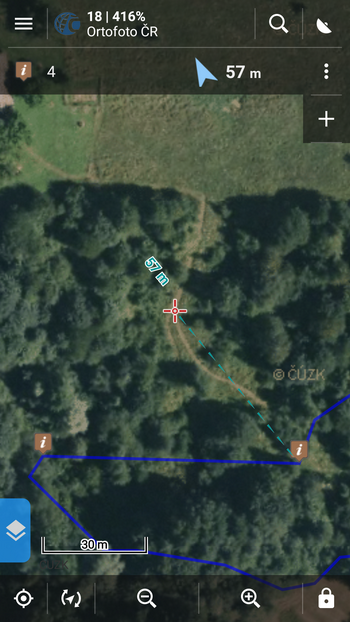
Even in the difficult terrain of the deep valley, the GPS mobile behaved fairly well and showed the position with promised accuracy of 3m. With Locus’s guidance, it was not a problem to set the plot at all. Again Locus gave us proof of his universality 🙂
cadastral mapsland registryplot


3 Comments
Ahoj
Díky za ukázku, přesně takhle jsem si plánoval zadat si do Locusu, všechny pozemky které potřebuji.
Jen dotaz na zjednodušení práce, je nějaký jednoduchý způsob jak získat ty rohové/zlomové body parcel, třeba z katastru, nebo to musím obkreslit a body si sám vytvořit?
Díky za radu.
Dobrý den,
při přípravě článku jsme měli souřadnice hraničních bodů k dispozici od majitele pozemku, ten je zřejmě získal od katastrálního úřadu. Vzhledem k nevelké přesnosti GPS zaměření na obyčejném mobilu ale bude nejspíš dostačující, když si parcelu obkreslíte a body sám vytvoříte. Samozřejmě pak takovéto zaměření nemůže být použito v oficiálním jednání o výměře parcely, je pouze orientační.
Hodně záleží na kvalitě (přesností) zdrojové katastrální mapy v daném k.u. Výsledek v terénu může být o hodně horší než ty 3m...