Obviously, many of you, hikers, mountain bikers, crosscountry skiers or other outdoor sports fans have already encountered a situation when you got a tip on a mesmerizingly beautiful crowd-less land. Immediately you decided to make a trip there, at least for one day, at best for a few days expedition. Alas, you couldn’t find a decent map! Either the area was badly covered by hiking maps or you found just topo maps without trails, shelters, and other tourist facilities.
Locus Map offers a solution – you can create your own map with it
With Locus Map you can:
- select a background map that suits your needs best
- add routes – draw them on your own or import them from other sources
- add interesting places, campsites, shelters, whatever – again, on your own or imported from many available POI databases
1. Background map
The base of your map project is created by a background map, describing the landscape you’re going to hike in. Usually it’s a topographic map that should be:
- offline – that’s a must in deserted areas without internet connection
- detailed – as much as possible but it’s not always easy to fetch one
- easy to read on daily sunshine-lit screen
Good offline map is an elementary premise of your successful trip. Locus Map portfolio contains a lot of good offline maps from which you should choose the best one. Consider a few aspects of them before you start downloading:
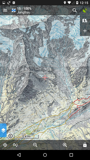
OSM based maps – maps containing OpenStreetMaps data are great to use in developed countries, especially in Europe – they are detailed, very accurate, continuously updated. Elsewhere in the world, better use OSM maps in populated places only.
Downloaded online maps – many great online maps can be downloaded to your mobile for free but be aware that not all of them are optimized for displaying on mobile phone screens – they are badly readable with tiny texts and other details:
Maps of local cartography publishers – usually very detailed and accurate but also quite pricy:
Satellite and aerial imagery – very convenient for planning routes but not all paths and roads are visible in forests, some parts can be covered by clouds. And one more thing – Locus Map is not built on Google Map API so it doesn’t contain Google satellite maps (it would be against Google terms of use). So satellite/aerial maps are available only in some parts of the world.
2. Trip route
Okay, you’ve selected and downloaded the right map. The map, however, doesn’t contain all paths and trails you need to go along. You’ve got two options:
- draw the route using Route planner – if you are experienced in reading maps plus you can use aerial images, you can draw the route manually
- import the route – you can browse Locus-integrated route database GPSies.com or import the route from outside of Locus as GPX file. There are many databases, e.g. Wikiloc or Wandermap
3. Points of interest
We have the map, we know where to start hiking and what trails to follow. Now we need some more information – about accomodation, tourist facilities, interesting places etc.
Locus Map can offer two solutions:
- OSM points of interest – they are part of LoMaps. Again, as all other OSM data, the database is very rich in Western Europe or other densely populated parts of the world but in some deserted backcountry areas you have to find some other POI databases.
- external POI databases – we’ve recommended some of them here, e.g. POIPlaza, US Campgrounds, POI-factory or database of cabins and bivouacs at Boudy.info. All of these support export to a GPX file through which you can import the desired POIs into Locus.
Lets go to Alaska!
For example, we decided to visit Kenai peninsula in Southern Alaska and we want to see inland lakes.
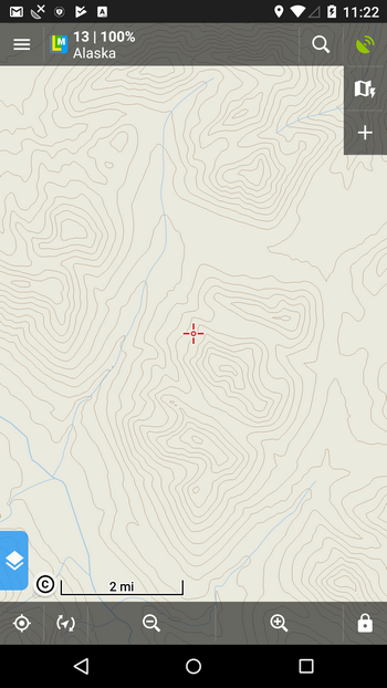
Maps – we decided for scanned USGS Topo Maps:
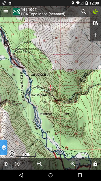
OSM-based maps in this area are very poorly detailed and other online maps are badly readable. Unfortunately, USGS allows only 10000 map tiles a day to be downloaded. Therefore, later we can download only the area where our trip will take place.
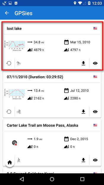
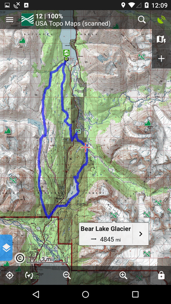
Route – before we search other databases we tried luck on GPSies.com. And hurray, we found a nice two day round trip starting on the lake Kenai shore:
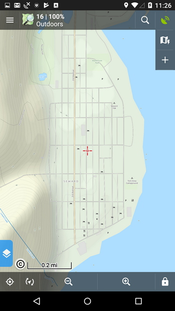
POIs – despite the USGS map is quite detailed regarding land and terrain, we’d like to have some more info at hand. LoMaps POIs at least, display peaks and some viewpoints around plus facilities in a nearby town of Seward. We also downloaded campsites from UScampgrounds.info and found out that one campground lie right at the head of our route.
All is downloaded and imported and our map looks like this:
Before we start though, let’s make it clear that you should always go into the backcountry with a paper map, compass and knowledge of how to use them. Smartphones can and do run out of power, may not be water resistant, be broken in falls etc. That is, don’t rely on them as the only one means of navigation and orientation. And pack also an extra powerbank or a solar charger. You never know if you’ll need it.
Enjoy your trip!
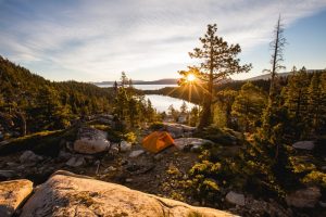
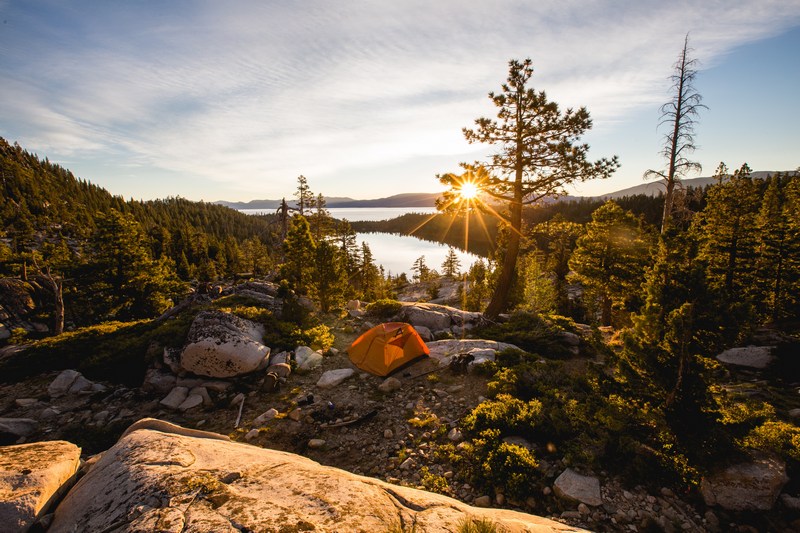
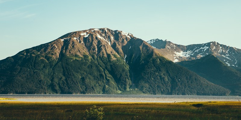
Photo by Austin Neill and Teddy Kelley at Unsplash.com.
backcountrymappingUSGS


2 Comments
Kurang nya informasi terbaru mengenai locus maps pro
Blogpost about the latest Locus Map version was published a few weeks ago: https://www.locusmap.app/news-version-3-33-0/