Last time we talked about maps helpful for your winter activities with Locus – LoMaps displaying cross country skiing trails and downhill skiing or ski mountaneering slopes or, areas suitable for snowshoeing and snow biking. We also presented Outdooractive maps containing layer of slope gradients indicating potentially risky areas with avalanche danger. Locus Map, however, can highlight such areas on any map as you will find below.
Slope angle matters
Avalanche terrain is terrain that is steep enough for the snow to slide. Basically, an avalanche releases when the pull of gravity overcomes the frictional forces holding the snow in place. The steeper the slope the more gravity is trying to pull it down hill, and in terms of avalanches, any slope steeper than 25 degrees is considered “steep.” Dry snow avalanches are most common on slopes of 30–45 degrees.
Locus Map can help you plan your ski mountaineering or backcountry skiing trips avoiding such areas . Slope gradient coloring identifies them and indicates the slope angle in three-color scheme. Yellow for <30°, orange for 35° and red for 40°and more. Check the slope coloring at various kinds of maps:
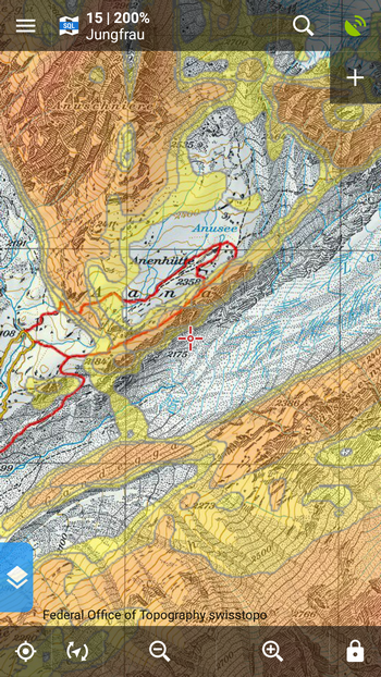
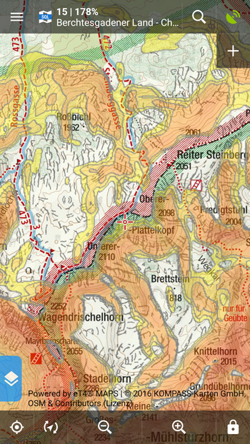
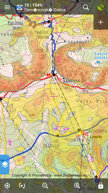
This coloring is rendered from elevation data (available for Locus Map Pro only) and can be set up in Locus settings > Maps > Advanced > Map shading.
Safety first – “My live location ” keeps your friends informed where you are
Cross or back country skiing is often an individual sport. Many of us set out to mountains to clear our office-blocked heads being alone.
Anyway, the weather and snow conditions can turn your brain cleansing trip to a nightmare. In such cases it’s often useful to be visible to the outer world. Locus can help your friends or family be informed about your actual location with My live location feature. Share your real-time position with it and your pals will see where you are.
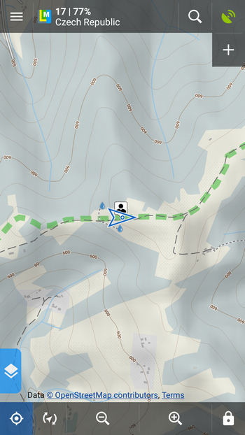
This is how you see yourself in Locus:
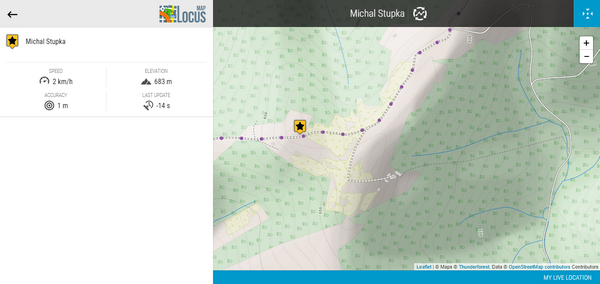
This is how others see you on their PC screens:
Turn it on from the Share menu:
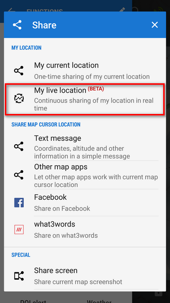
Then send a unique URL address displaying your position on map in any web browser to whoever is interested.
Keep your fingers warm
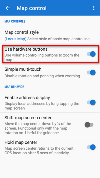
Don’t pull your gloves off more than necessary because of controlling your phone – your fingers can lose warmness very quickly in freezing temperatures. Here are a few tips how to keep Locus gloves-friendly:
- keep your position in the map screen center (long tap centering button in the bottom left and check “Hold map center“)
- deactivate screen locks so that you can turn the screen on without need to swipe (settings > display > disable screen lock)
- use volume buttons to zoom the map in or out (settings > maps > map control > use hardware buttons)
Enjoy your winter activities even more! Next time we’ll show you how to set hands-free and screen-free voice navigation for easy orientation on your cross country skiing trip. Follow our blog or Facebook.
backcountry skiingcross country skiinghardware buttonsMy LIVE locationski slopesslope gradients


5 Comments
Farbverlauf über die Hangneigungen sieht gut aus. Habe schon verschiedene Karten probiert aber leider funktioniert es bei mir nicht ???
Hi, and do you have elevation data downloaded for the other areas?
Ein sehr tolles feature mit den Hangneigungen!
Allerdings habe ich beim vorhergehenden Artikel, der die Karteneinfärbung nach Hangneigung erstmals erwähnte, keine Legende dazu finden können. Deshalb habe ich mich gefreut, in diesem Artikel eine Erklärung der verschiedenen Farben zu finden.
Generell würde ich es sehr begrüssen, die Legenden der Karten und deren layovers einfacher auffindbar zu machen. :)
I hope we can see a good discount for the app around Christmas this year!
There will be a discount, but not for the app :)