
The summer is in full swing and we are publishing a brand new version of your most favourite app. Again, it contains tens of fixes and small improvements, but also a few major enhancements we developed according to your ideas:
More accurate trip planning with new estimated time box
When you plan a trip, a workout route or a bike ride, you usually tell Locus a few facts – what activity you are going to do on the route and what particular places you need to visit. Locus measures the length of the planned route, shows its elevation chart and calculated elevation gain so you can imagine what your trip will look like. Now, it can show your how long it will take!
The estimated time box you can find in the bottom bar of the Route planner:
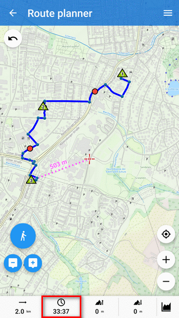
The time is calculated by a new algorithm delivered by our routing partners GraphHopper and BRouter, interpolated with your average speed of selected activity.
New clear and simple Live Tracking manager
We are going on improving our real time location sharing service – Live Tracking. As we had hinted last time, we’ve been preparing a brand new screen of Live Tracking manager:
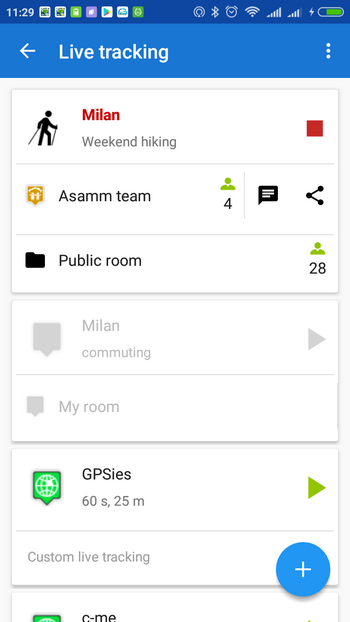
Now you can:
- clearly distinguish among your defined Live Tracking profiles
- simply start and stop them
- see how many active people are in selected rooms
- quickly enter livetracking chat in selected rooms
Simple Locus Store log in without contacts permission
Many of you have wondered why on Earth Locus needs contacts permission. Locus doesn’t need to know your contacts – it just needed your Google or Facebook account e-mail for Locus Store identification. Nevertheless, Android has this permission in a bulk with contacts so we spent hours explaining that it is not our fault.
Hurray, Locus doesn’t need to know your email any longer, nor does it need the “contacts permission”.
Login to Locus Store is now processed directly by Google or Facebook:

Enjoy your summer adventures with the new Locus Map!
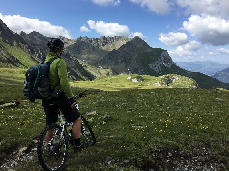
Photo by Kay Liedl on Unsplash
live trackinglocus storelog inroute planning


4 Comments
The new version is even more comfortable. This is perfect. Thanks! Dekujem!
Thanks a lot for this new update.
Just a comment about the new calculated time displayed on the lower bar of the Route Planner : it is rather wrong. Same comment for the time computed on Travel Time (Route Menu) which is rather too high.
For example time compute with this GPX (with BRouter) :
02:29:26
Travel Time : 4:16 of movement + 1:30 of rest
With this GPX loaded on Swisstopo :
03:36
GPX to download : https://www.visugpx.com/download.php?id=qi8JmTQxH4
Load the GPX (drag and drop) on http://map.geo.admin.ch
Click on the track and "Display profile"
With my own experience (I am a mountain leader), Swisstopo is the most accurate time calculation.
Yours,
Daniel Ribagnac
Thank you for the feedback, have you tried also latest version 3.32.2.? We readjusted the ETA option a bit. Nevertheless, the time calculation is just rough estimation of the time on route.
Hi,
I recommend to provide those parameters (with default values) which the user can modify according to his skill:
- horizontal speed
- ascent speed
- descent speed
With this the calculation of the trip time is quite easy.
There is a German guideline (DIN 33466) for this calculation:
https://de.m.wikipedia.org/wiki/Marschzeitberechnung
The total trip time is calculated this way:
- horizontal trip time "th" using horizontal speed
- vertical trip time "tv" using ascent time + descent time
- total trip time is the larger value of "th" and "tv" plus half of the other value.
Example:
Horizontal speed: 5 km/h
Ascent speed: 400 m/h
Descent speed: 600m/h
Horizontal distance: 15 km
Ascent: 800 m
Descent: 800 m
==>
th = 15 km / 5 km/h = 3h
tv = 800 m / 400 m/h + 800 m / 600 m/h = 3.33 h
Total trip time = 3.33 h + 0.5*3 h = 4.83 h