
When you are moving in free terrain with no roads or paths, heading to a distant target – a hunters cabin, a watch post, or, most likely, to a geocache – navigation is of no help. “Navigate to” feature renders a route along roads and paths and “Navigation” needs a route to navigate along. Without roads, paths, and routes, the only way how to get to a particular spot is to use guidance.
Start at the target
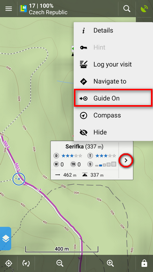
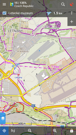
To launch the guidance line, showing distance and azimuth of the target, just tap the target and select Guide ON from the action menu:
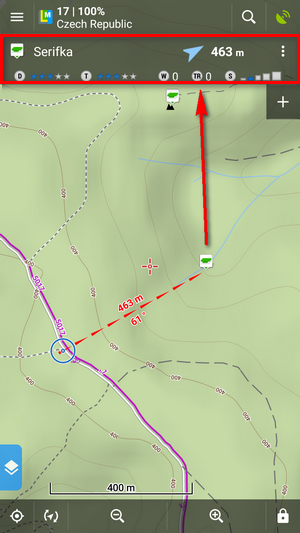
All you need to know about the target is displayed in the guidance panel. In case of a geocache, you see its name, direction, distance, difficulty, terrain rating, number of waypoints, number of inserted travel bugs and size of the cache box:
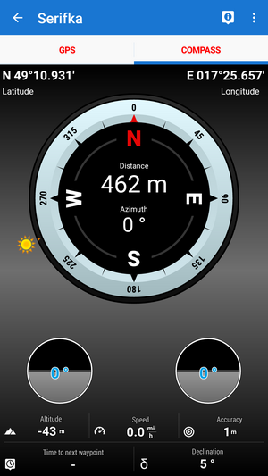
If you prefer compass view, switch to it from the guidance panel menu:
Don’t watch the screen all the time – put on alert
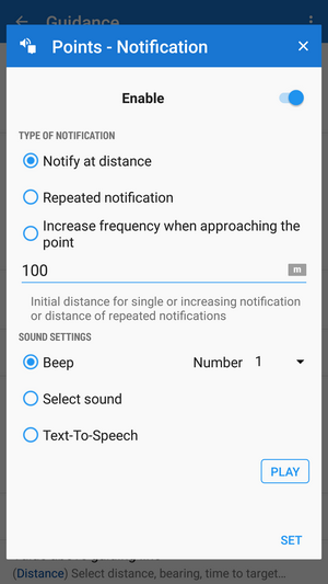
In a difficult terrain where you have to be careful about where to put your feet and not to break your ankle, some acoustic alert may help. In the guidance settings, you can choose a single alert or alert with increasing frequency as you are getting closer to the target. Of course, you can select plain beeping, your own sounds, vibration or spoken alerts, informing about the target distance and direction:
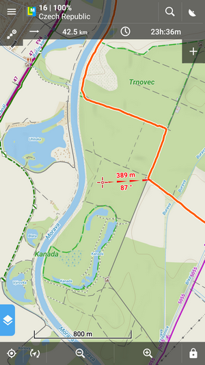
The closer to the target, the more detailed map you see
Locus Map can zoom the map automatically according to the distance from the point you are guided to – the closer the target is the bigger zoom is displayed so both your position and the target are visible on the map screen:
Low battery? Locus Map will turn the screen on just when you need it
The screen on/off control in Locus display settings offers a few options on how to turn the phone screen on automatically only when you need it. One of them is during the point guidance:
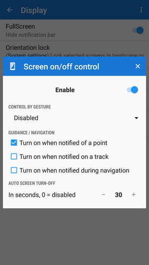
The screen lights up just in time of the point alert so you can quickly check the map. This feature is especially useful when Locus guides you along a route, switching the screen on only on turns.
Guidance along a route? What is it for?
It is useful, especially for sailing, sea-kayaking or flying. Also for cross-country hiking when there are no roads for turn-by-turn navigation – Locus guides you along a manually drawn line and notifies you of the direction changes.
Alert! You’re off your route!
That’s an especially useful feature when you are guided with your screen off, listening only to voice commands. Sometimes, it happens you miss a turn or you’re forced to make a detour. The guidance doesn’t recalculate your route but Locus Map notifies you of its leaving. When you set up text to speech, Locus Map tells you how far and in what direction your original route is running.
So, let’s go off road with Locus Map!
backcountryfree terraingeocache guidancegeocachingguidanceoffroadvoice commands


9 Comments
Your compass view picture is missing the white triangle on the outside border for indicating the course.
Hi Henk, the picture was made on an Android emulator with mocked GPS position but it has no effect on the feature itself.
Locus Map can zoom the map automatically according to the distance from the point you are guided to – the closer the target is the bigger zoom is displayed so both your position and the target are visible on the map screen:
How do I activate this function? I couldn't find out on the link you provided
Hi, go to Locus settings > Controlling > Map screen > Zoom according to speed.
The article says zoom by distance, not zoom by speed. I know aboat zoom by speed
Hi, this is the same feature, only it works a bit differently when guiding on a point
Years ago, I used these functions as an auditory aid while staking mining claims in NW Ontario. Blazing lines on a specified azimuth through thick bush, had to stay on a tight course. I had it setup to notify when deviating off course, and to guide in tighter when approaching target every 400m. Nothing beats a real compass and skill, but it was interesting how well this worked.
LocusMap has been my go-to program for any mapping needs, love it. Great work Locus team.
Пока самая лучшая прлграмма из встреченных.
Prostě nejlepší programek na světě. Díky!